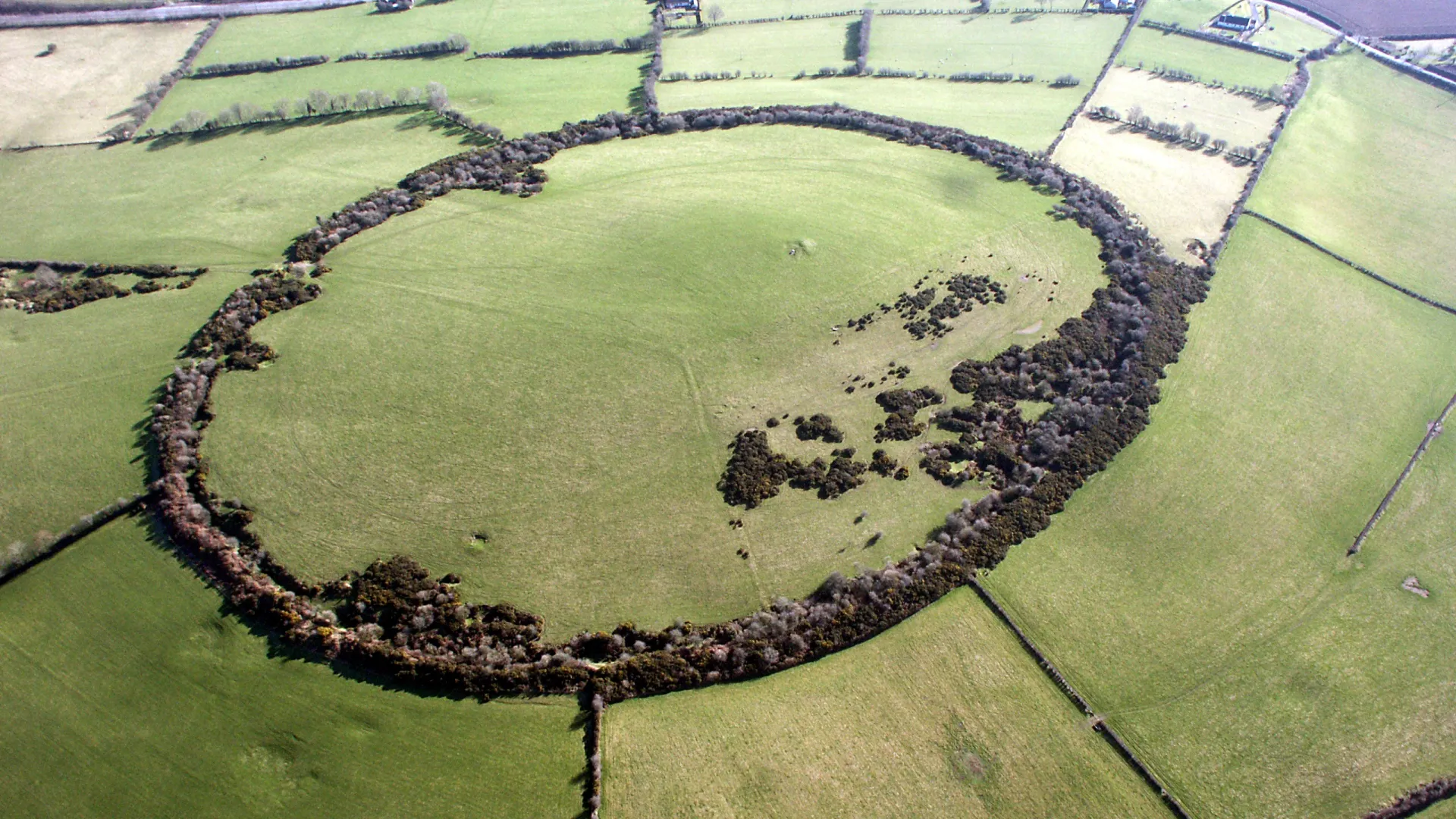
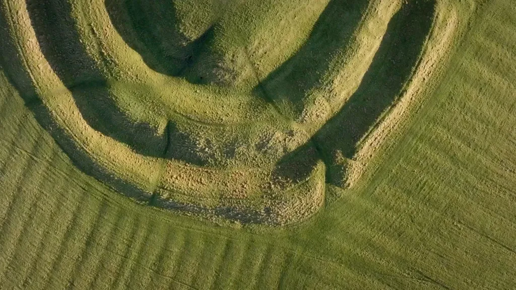
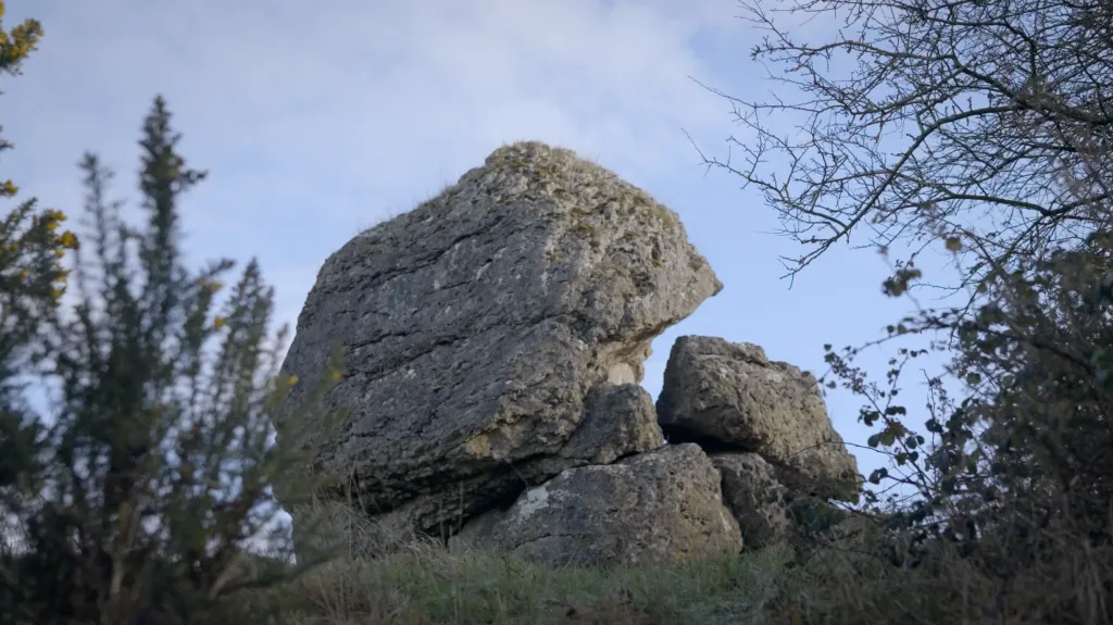
Dún Ailinne is situated on the edge of the Curragh and close to Old Kilcullen, an early Christian ecclesiastical centre. It is sited on the rounded summit of the highest hill in the area and is a dominant feature in the landscape with panoramic views. The most visible feature today is a massive bank with an internal ditch surrounding the hill top. Major excavations from 1968 – 1974, and smaller interventions since then coupled with extensive geophysical surveys provide evidence for the complex archaeology of this site.
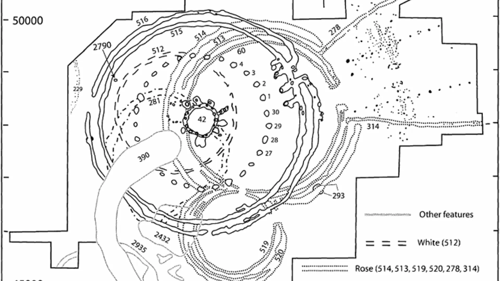
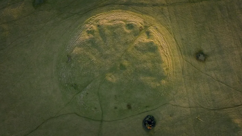
Dún Ailinne consists of a massive bank and ditch enclosing the summit of an entire hill, built sometime after 700BC. The enclosure, 474 metres in diameter, probably defines the ceremonial space of this royal site, and is similar to the large ceremonial enclosures at Tara and Navan Fort (Eamain Macha). Archaeological excavations have shown that there was activity on the hill top since the Neolithic, and have also uncovered a complex series of Iron Age timber buildings. These circular timber structures appear to have been ceremonial buildings built over three broad phases. What remains of these structures are the pits and ditches dug during their construction. These are studied by archaeologists in order to understand how these structures were built and might have functioned in the past.
Neolithic – Iron Age
KEY FEATURES
Dún Ailinne features a vast ceremonial enclosure, with evidence of complex timber structures at the centre of the enclosure built and rebuilt through the Iron Age, and the remains of feasting and craft production. These features suggest a powerful ritual centre, where political authority and seasonal gatherings asserted the Leinster kingship.
Dún Ailinne is defined by a massive circular earthen bank- the largest of the Royal Sites enclosures with an internal ditch, an architectural form that is symbolic rather than defensive. Encircling about 13 hectares atop the hill, this enclosure is understood to have set apart a sacred ceremonial zone. Navan Fort, Rathcroghan and Tara have evidence of comparable circular earthen banks.
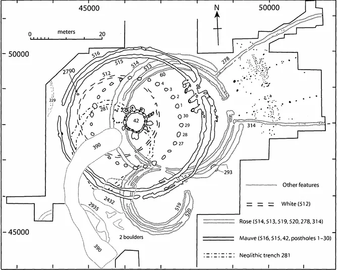
Excavations have revealed three successive phases of timber structures built in concentric ring patterns within the enclosure. Beginning with a simple circular palisade (White Phase), it evolved into a complex figure of eight structure with a funnel‑shaped entrance (Rose Phase). We know little of how this ceremonial structure was used but it is very similar to a structure found at Navan dated to about 150BC. The third Mauve Phase revealed an elaborate double palisade encircling smaller timber circles.
Visit Dún Ailinne
Not Accessible to the PublicNot open to the public,
site is on private land
Knockaulin Hill,
near Kilcullen, Co. Kildare
Other Royal Sites
Follow in the footsteps of Ireland’s High Kings on the Hill of Tara
Explore where kings knelt and churches rose
Step into the stronghold of warriors and legend
Stand at the centre where Ireland’s provinces meet
Uncover tales of Queen Medb and ancient passageways