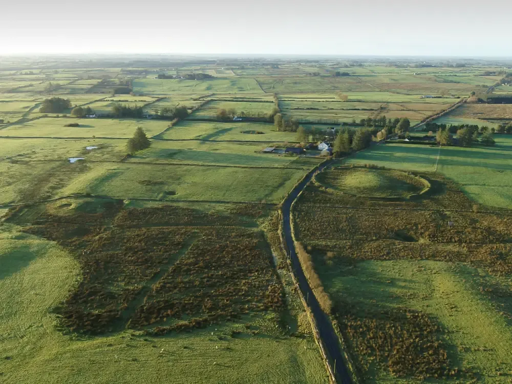
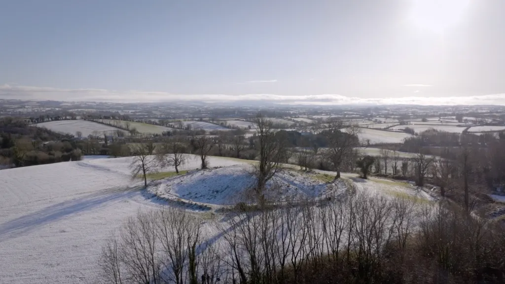
Rathcroghan is located on the summit of a broad limestone plateau with the highest vantage rising to 150m above sea level. There are panoramic views over much of Connacht and beyond from its focal mound. The plateau has a large number of surviving archaeological sites ranging from the Neolithic Period through to the Medieval Period, with the most intense use in the Iron Age and Early Medieval period. Rathcroghan has not been the subject of major excavations but has been assessed through generations of fieldwork and through extensive geophysical surveys.
The Rathcroghan landscape boasts over 266 identified archaeological sites, spanning a staggering period of over 5,500 years of human history. It is the location of numerous prehistoric burial mounds, ringforts (settlement sites) of early medieval and medieval date, standing stones, linear earthworks, stone forts, an early church site, a great Iron Age ritual sanctuary at Rathcroghan Mound, and a reputed portal to the Irish Otherworld at Oweynagat cave. Together, these features reflect a sacred royal landscape of ceremony, kingship, and mythology, with continuous use from at least the Bronze Age through the medieval period.
KEY FEATURES
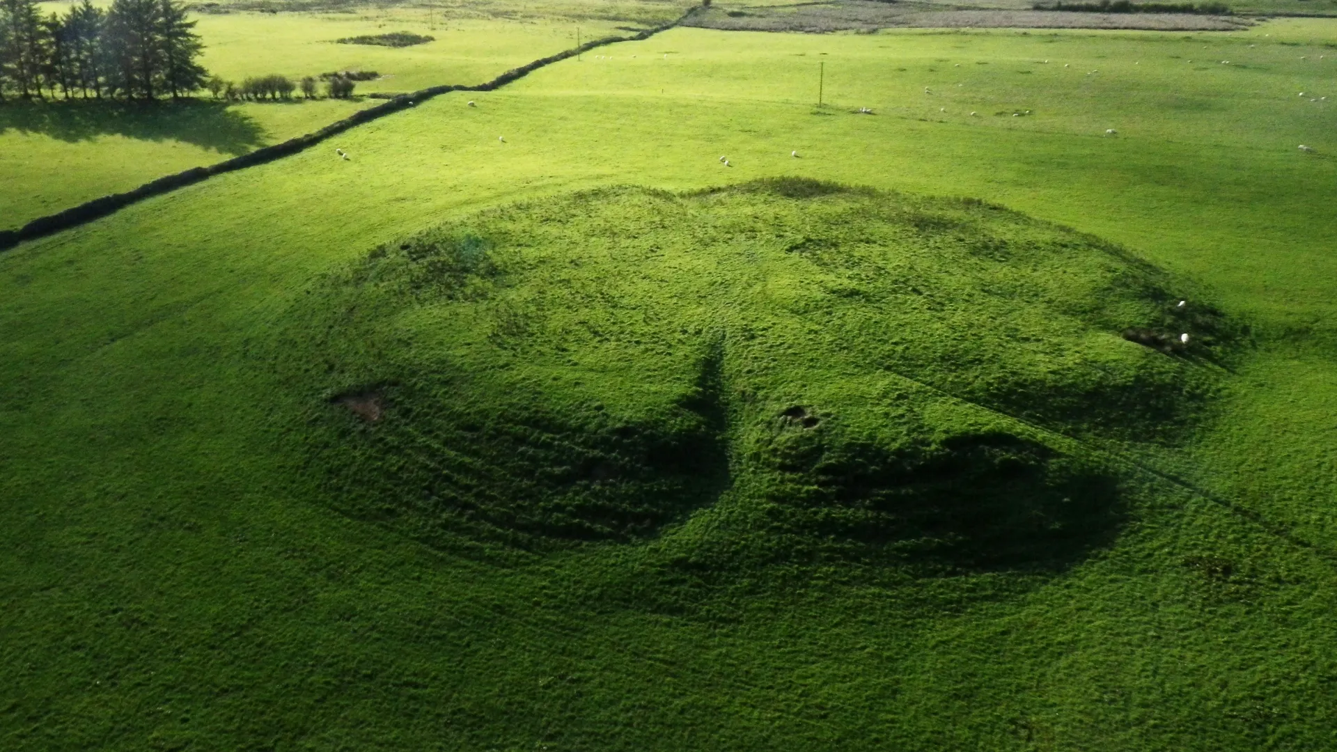
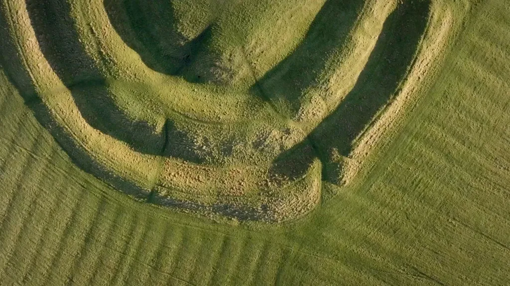
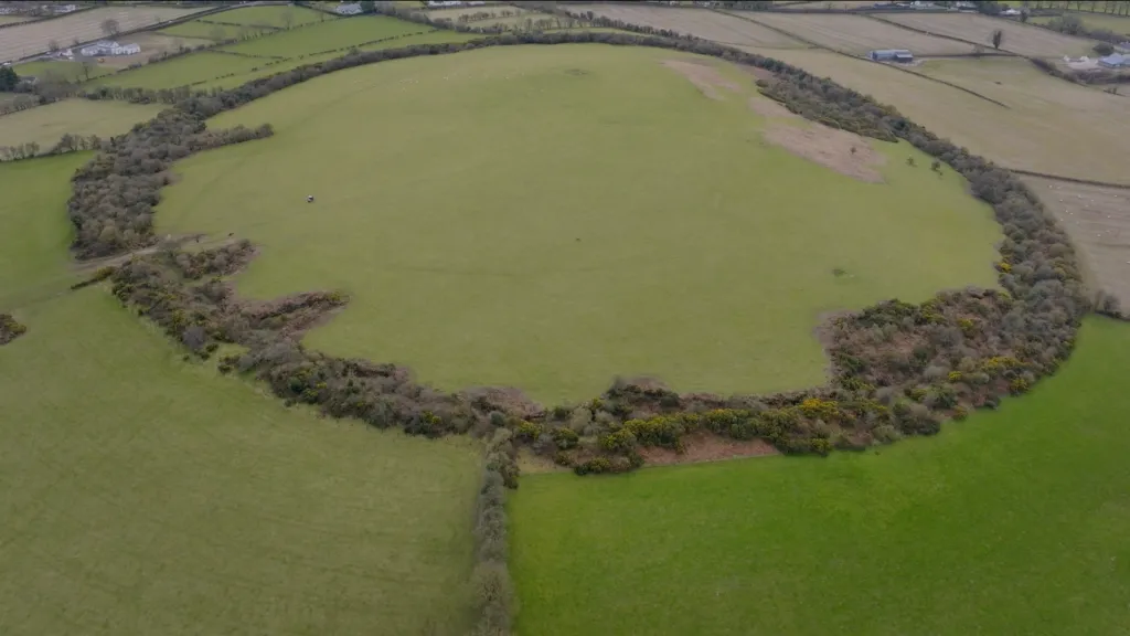
Rathcroghan’s archaeological landscape is centred on the monumental Rathcroghan Mound. The Mound is surrounded by an enclosure ditch 360m in diameter. There are some small monuments visible in its immediate vicinity, along with many buried features including at least ten ring barrows, a ring fort, and three very small earth and stone mounds. Non-invasive archaeological surveys may suggest millennia of use, and that Rathcroghan Mound and its immediate surrounds once served as a celebrated centre of ritual and ceremonial activity in late Iron Age and early medieval Connacht.
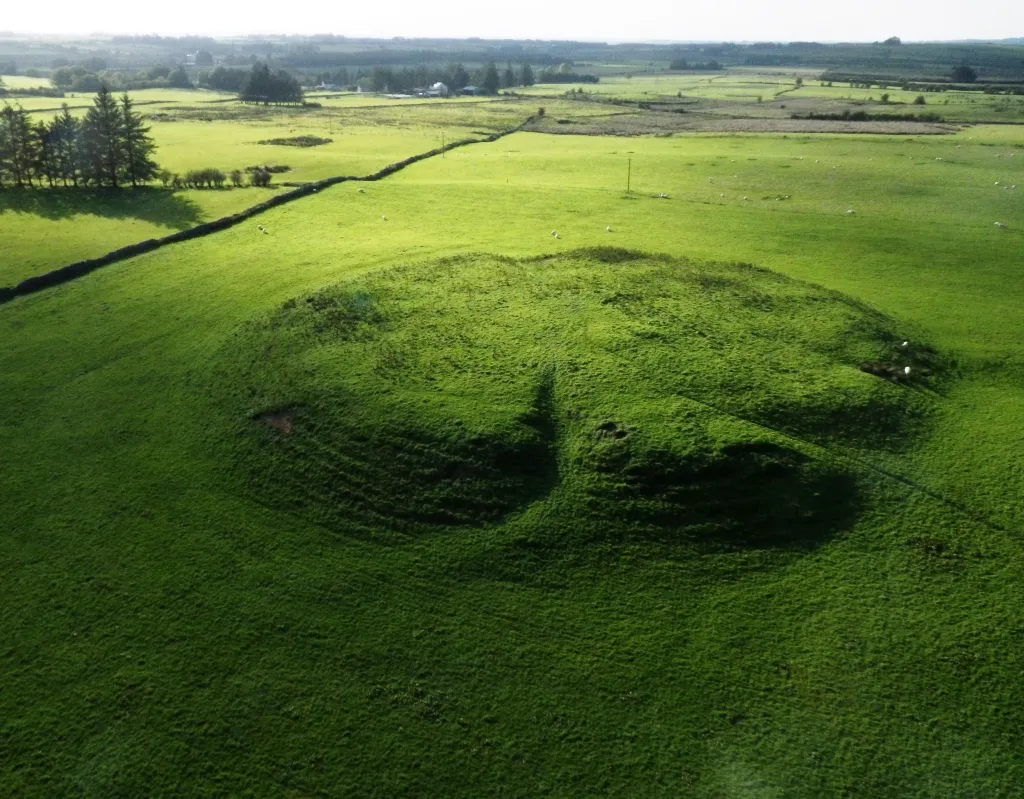
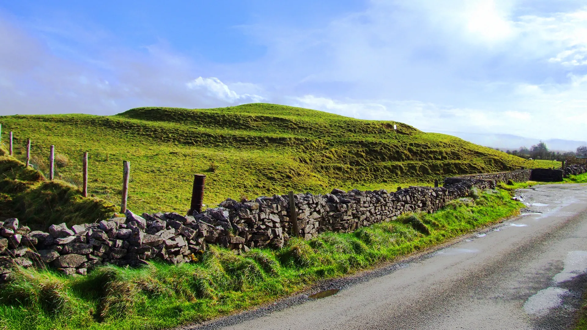
The focal point of this archaeological landscape is Rathcroghan Mound. 85m in diameter and 6m high, it is perched on the summit of the great limestone plateau which characterises this area. Surrounded by a 360m diameter enclosure, this quiet field today was once filled with monumental architecture and busy with people. Geophysical surveys have shown the Mound to have a complex, multi-period, internal structure constructed in several phases. Deep inside are two circular stone settings or stone walls, of 22m and 35m diameter respectively. On top of the mound, non-invasive surveys revealed a double circle of post pits around a circular stone core, 32m in diameter. This is likely to be the remains of a large-scale, possibly roofed, timber structure, which would have once stood as a major statement over the immediate region.
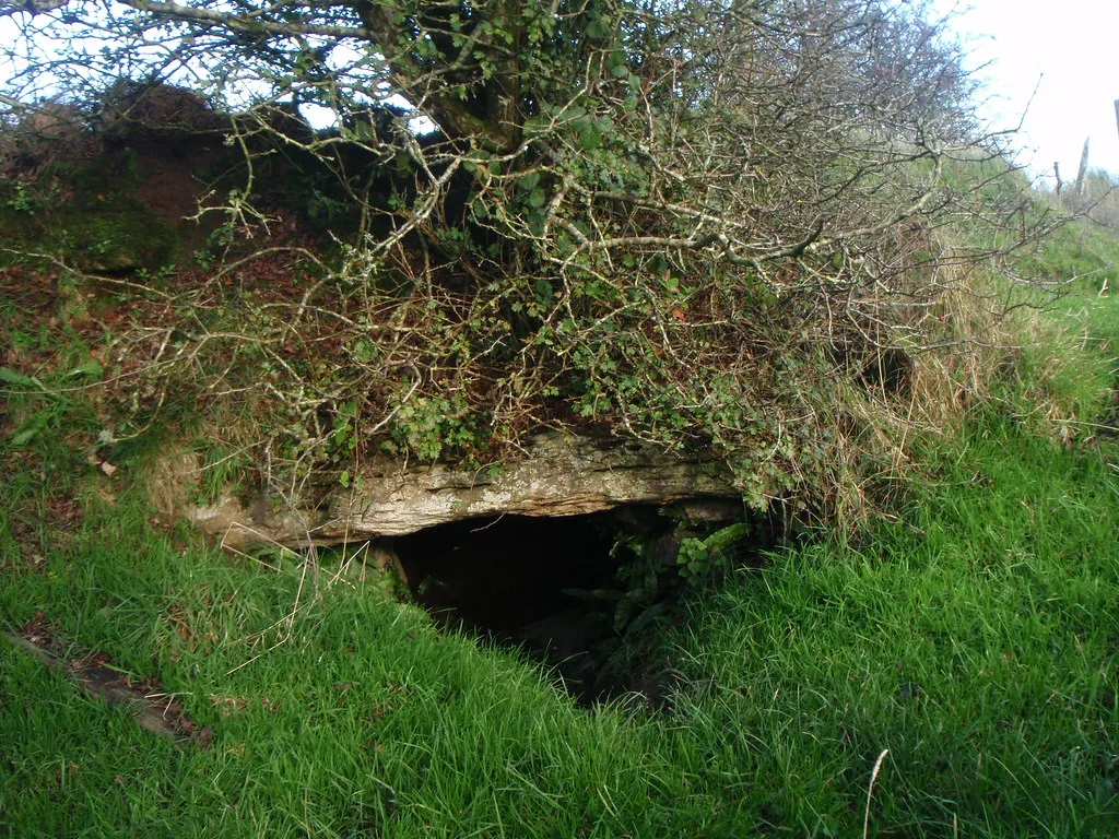
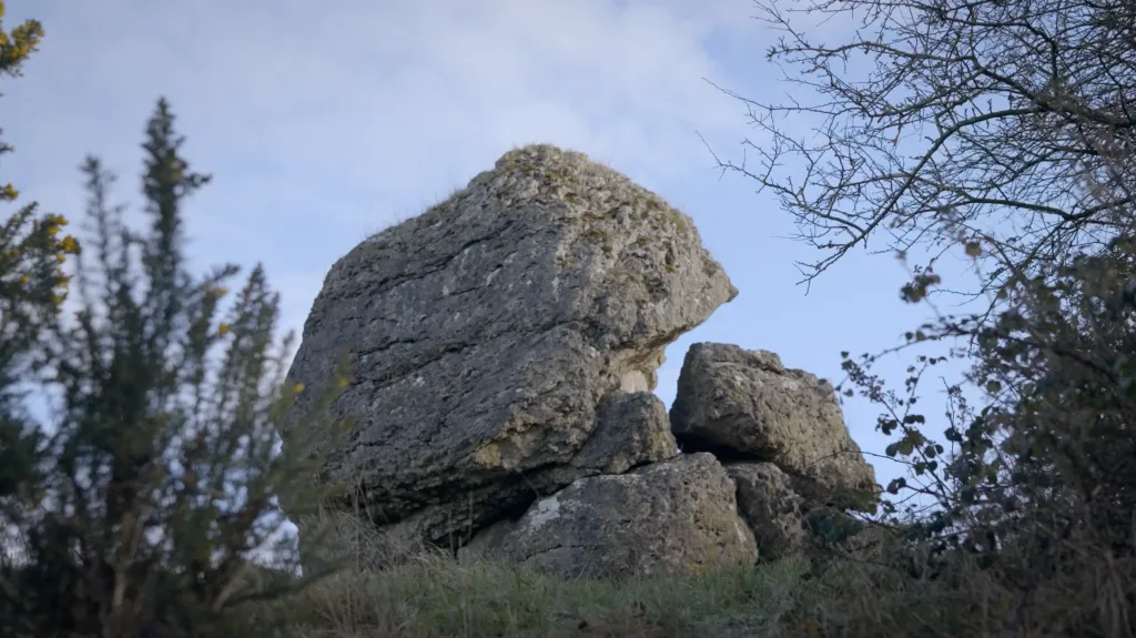
Uaimh na gCat, The Cave of the Cats is described in our early literature as one of the principal portals into the Irish Otherworld. This extensive limestone cavern was venerated by the communities who resided at Rathcroghan in the early medieval period, to such a degree that they constructed a formal entrance and passageway to provide access into this geological phenomenon. Ancient ogham inscriptions are to be found within the passage entrance, while the early medieval literary sources are replete with tales which concern the cave. These are particularly associated the Morrigan (Ireland’s battle goddess), monstrous creatures, warriors, and with the ancient seasonal festival of Samhain, the modern Halloween. This monument is not safe to enter or access.
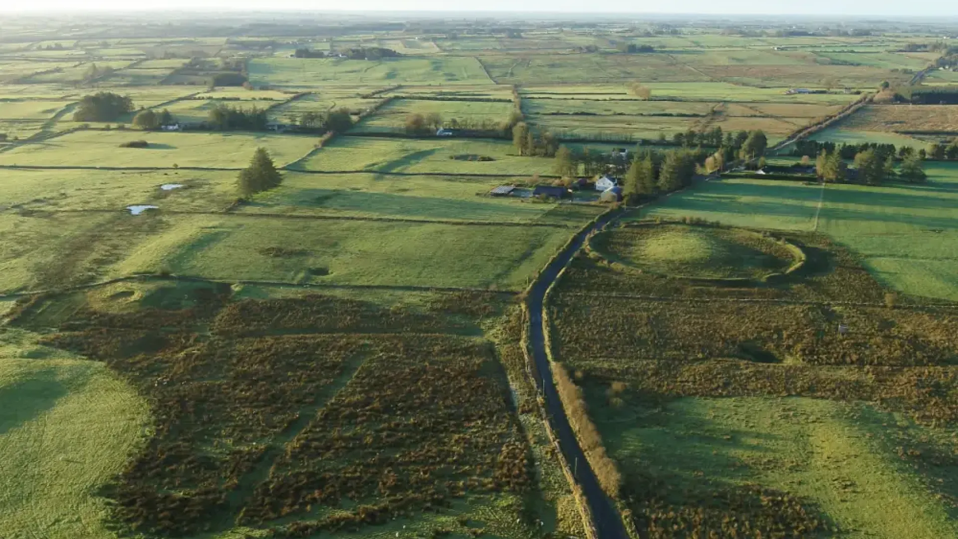
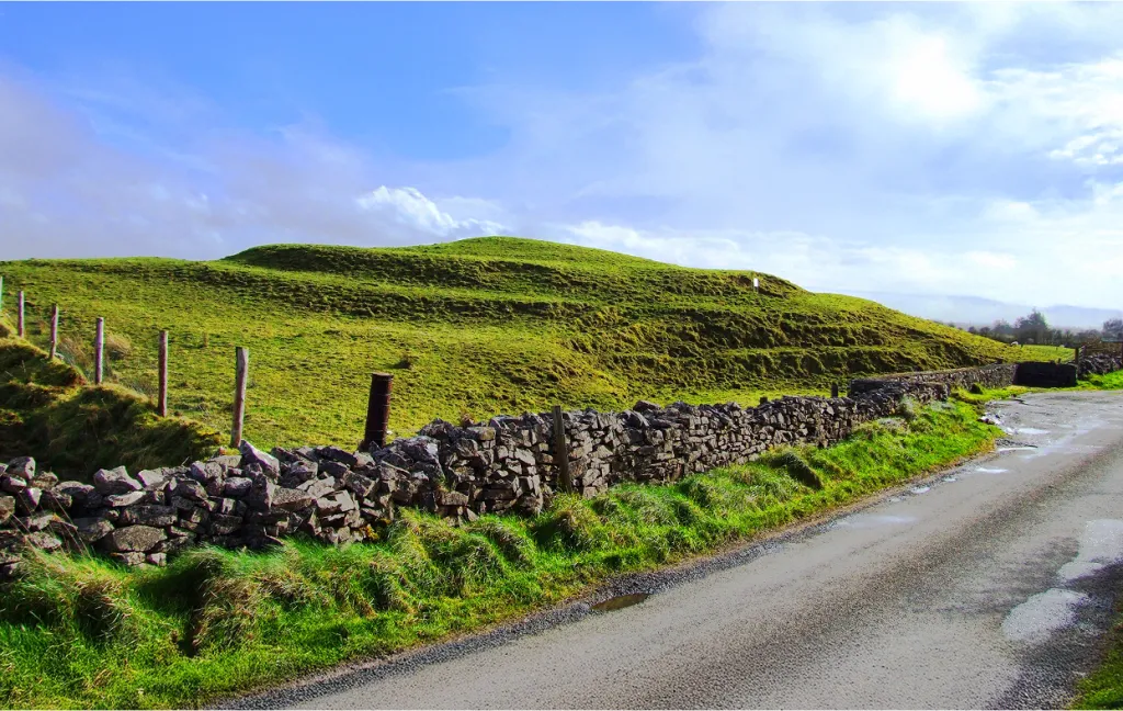
One of the indicators that Rathcroghan was and is one of the most important and uniquely preserved archaeological landscapes in Ireland corresponds with the large numbers of, primarily earthen, monuments which are still evident in the fields around Rathcroghan Mound. Dozens of Bronze and Iron Age burial mounds, such as Rathbeg, Caran Fort, Daithí’s Mound, Rathscreg, Carnakit and others, attest to this place being described as a ‘Cemetery of Kings’, while medieval elite settlement sites, chief among them Rathmore, Relignaree and Cashelmanannan, confirm Rathcroghan as a place of extraordinary importance throughout the millennia.
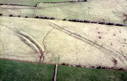
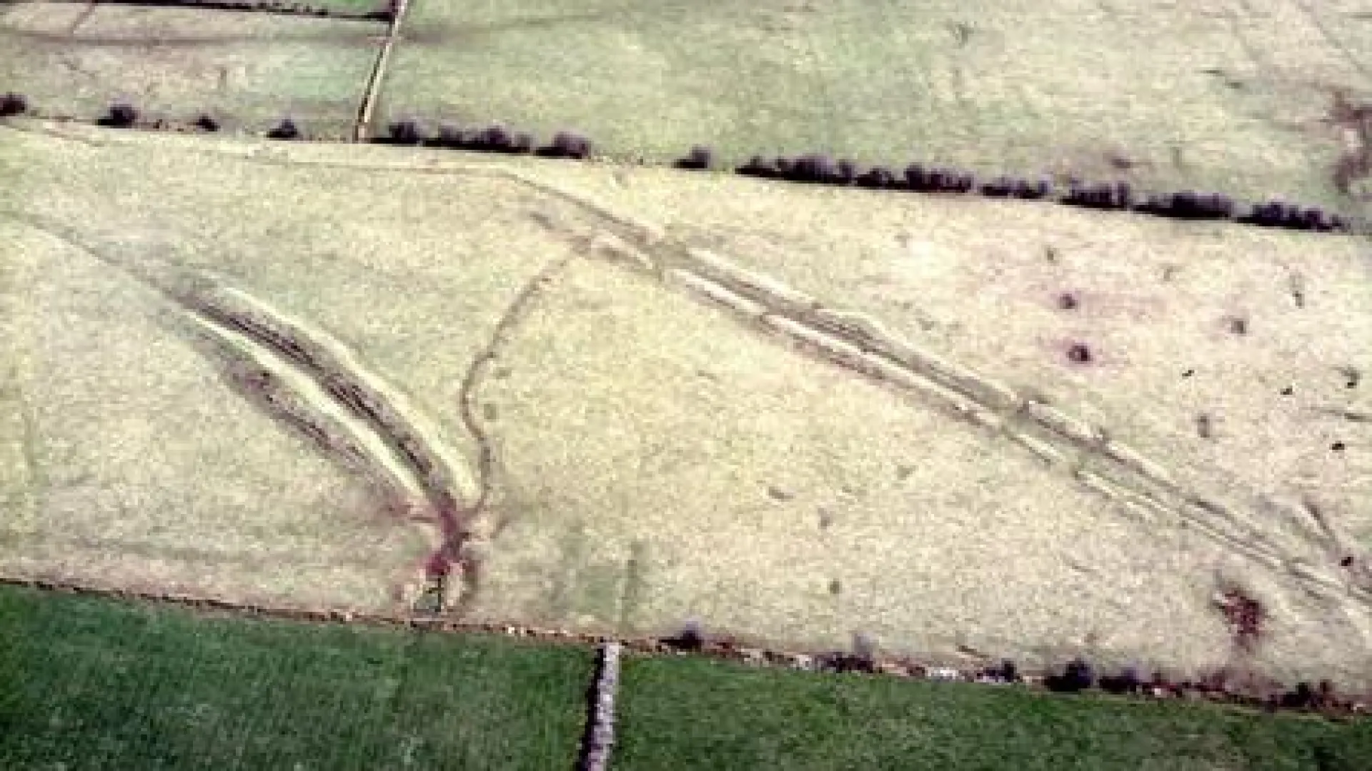
The Mucklaghs are a monumental pair of linear earthworks located on the southern slopes of the Rathcroghan plateau, and are said to have been caused by the rootings of a magical boar who emerged from nearby Oweynagat.They consist of two pairs of parallel earthen banks which extend to a maximum of nearly 300m in length, and may have served as a formal route of approach towards the monuments at the top of the plateau , but they could be compared with the Banqueting Hall at Tara and the Knockans at Teltown in Meath.
Rathcroghan’s central place in the early Irish literary tradition elevates Its significance still further. Its connection with sagas such as the Táin Bó Cualinge and Acclamh na Senórach speak of its retained value to early medieval society, coupled with its mention in, particularly, Patrician hagiography. The names in the physical landscape then reflect these great epics with Rathcroghan being the muster point of Queen Medb’s armies, Rathnadarve the place where the magical bulls Finnbennach and Donn Cuailnge did battle, and burial mounds like Carnakit and nearby Carnfree the final repose of the heroic warriors of these tales.
Visit Rathcroghan
Site is Accessible All Year RoundPaid access to visitor centre and tours
Tulsk, Castlerea,
Co. Roscommon, F45 HH51
Mon–Sat
9:15–17:00
(last admission 16:30)
Same as opening times
Other Royal Sites
Follow in the footsteps of Ireland’s High Kings on the Hill of Tara
Explore where kings knelt and churches rose
Step into the stronghold of warriors and legend
Stand at the centre where Ireland’s provinces meet
Leinster’s royal stage, alive with ceremony and rivalry